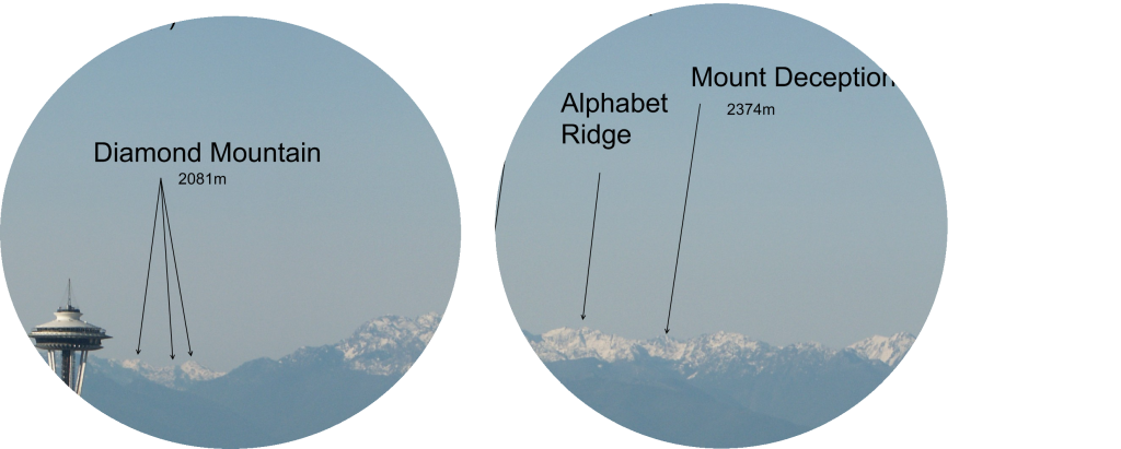
Landmark-identifying goggles
Problem: There’s a great view of some mountains out of my window, but I’ve had a devil of a time trying to work out which one is which.

Solution: Landmark-identifying goggles. The name probably needs some work; branding doesn’t seem to be my strong point. Anyway, these are glasses, inside which there are little screens in front of your eyes. Those screens are transparent (so you can see what’s really in front of you) but able to overlay text on your view. The glasses are equipped with a GPS, a compass and some tilt sensors so they can tell where you are and which direction you are looking in. They can now overlay identifier text onto the real view through the screens.
For the case here, where I’m just using them to identify mountains, they would have a database of mountains built into them. Of course, if they were connected to the internet then there’s a whole load of other possibilities. I hate to use the word, but this would be a great mashup for Google Earth/Live Maps. You could use them to highlight anything on overlays that people had created for those apps. Buildings, street names, Wikipedia entries, places where famous people died. Taking things one step further, you could even connect them to live data. How about looking at a plane and having these fine goggles identify it as flight 463 from Tokyo?
This is a little far-fetched with current technology, but we’re not a million miles away. We already have mobile phones which contain a camera and a GPS – it wouldn’t be too hard to show the view from the camera on the phone screen, with data from Google Earth overlayed on top. You’d have to assume they were holding it level and they’d have to walk along a bit in order for the GPS to work out what direction they were looking in, but hey. It could be a new sort of fitness kick. I’m on fire here.